Search the Community
Showing results for tags 'factbook'.
-
https://www.nationstates.net/nation=dexian/detail=factbook/id=2661092 Factbook of Dexian. Will be consistently updated with any new factbooks I add
-
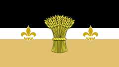
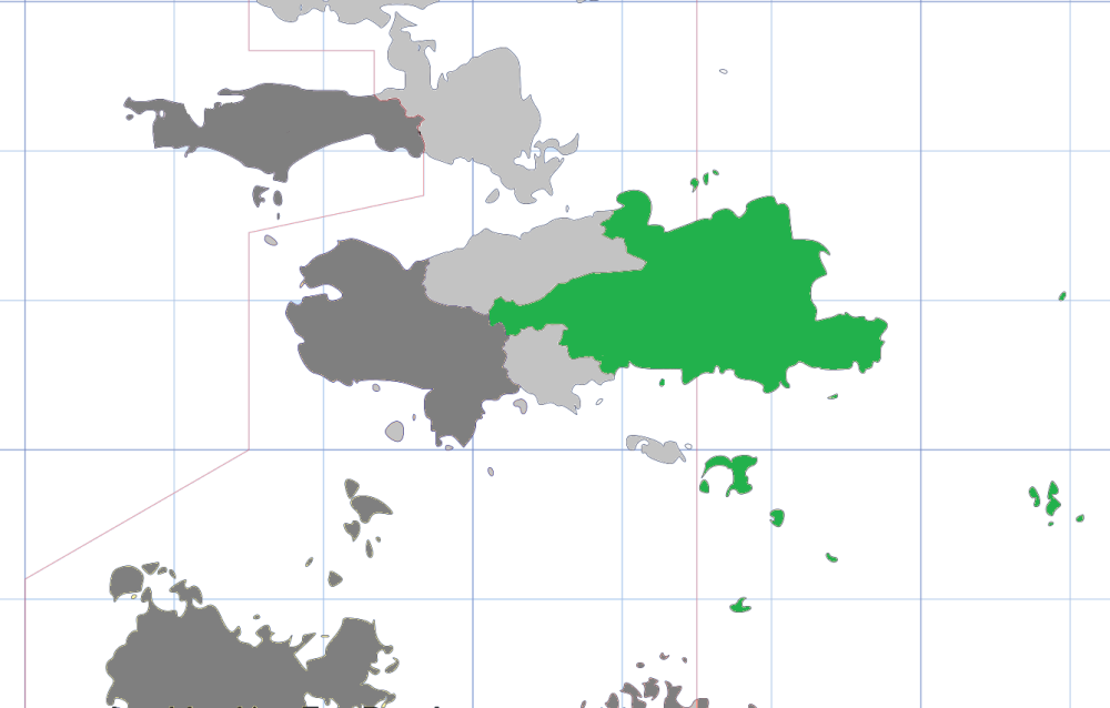
Overview Location (green) in Nur: Placeholder Capital and largest city: Eschershaven Official languages: Kalmash, Iknupatak Ethnic groups: 56% Kalmash 21% Mixed 16% Iknupatak 7% Other Religion: 42% Reformed Yellowist 12% Iknupatak 11% Yellowist 4% others 31% no religion Demonym: Kikuyatan Government: Placeholder King: Placeholder Prime Minister: Placeholder Senato President: Placeholder Chief Justice: Placeholder Legislature: Placeholder Formation: Placeholder Total area: 25,685 km² (9,917 sq mi) Population: 1,355,674 Density: 52.8/km² (136.7/sq mi) GDP (nominal): $58,547,485,213 GDP per capita: $43,187 Currency: Kikuyatan krone Time zone: IAT+7 Calling codes: +5 64 Letter codes: KT and KYT
-
Republic of Clarinatia (Républica Clarina) Flag Motto: Non Turbata Prosperitas Location Population: 9,176,665 (66th) -Density: 15.1/km2 Capital: Rigset Largest City: Rigset Official Language: N/A National Language: N/A Demonym: Clarinatian Government: De jure Elective Monarchy, De facto Direct Democracy - Elected King: James IV Rigset Legislature: Noble Administrative Council (unicameral) Land Area: 235,299 mile² (609,422 km²) 26th GDP (PPP): $411,215,519,336 (44th) GDP per capita: $44,811 (17th) Currency: Clarinatian Note (cn) Time Zone: IAT +8,+9 Driving Side: Right Internet TLD: .cl Calling Code: +5 97
-
|WIP| The Grand Duchy of Teutokrainiya |General| Teutokrainiya (Velikoran: Velikorènskaya Gherzovka; Krautsprechen: Großherzogtum Teutokrainien) is a multiethnic Grand Duchy located in Southwestern Polaris. Rich in history and culture and shaped by centuries of coexistence between the Teutovolksen and Velikorran peoples, Teutokrainiya is known for it's military traditions and nationalistic population. The nation shares borders with Podium to the north and the Holy Qostaoyae to the south. The capital city is Ordensburg, a fortified city that was created centuries before the establishment of the Grand Duchy. Just outside of Ordensburg is the Kravari Family Castle, which hosts the seat of current Grand Duke Albrecht II Kravar. Other major cities include Eisenfelden, Blausdorf, and Chernevetz. Teutokrainiya has a total population of approximately 10.77 million. The nation has a population density of 114.9 people per square miles, extending a total land area of 93,738 square miles. Economically, the country boasts a Gross Domestic Product (GDP) of around $341.6 billion USD, and a GDP per capita of $31,719. The national currency is the ₸ Krevalten Papiermark (KPM), a symbol believed to have evolved from the initials “TT” or “TK” representing the nation’s founding. Teutokrainiya officially recognizes two national languages: Krautsprechen, spoken primarily by the Teutovolksen population in the south and east, and Velikoran, used predominantly in the northern and western regions. Both are taught in schools and used in official documents, with citizens typically fluent in both. Each language is written in its native script although transliteration is often done in Common. The national anthem is "Stend Kravari", old patriotic song that still remains prominent today among the countryside. The national animal is the Müllerhund, a large slim dog with little fur. It was once used for hunting purposes before being used by the royal family. It is one of the many important symbols to Teutokrainiya.
-
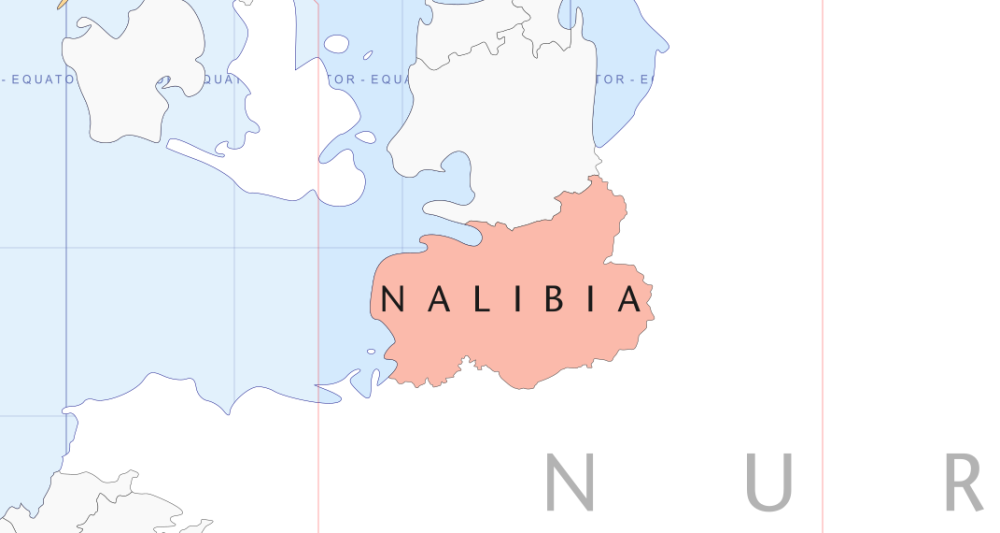
This Page is intended to outline in summary or detail all aspects of the nation of Nalibia. With time I hope to include facts, histories, mythology, holidays, culture, cuisine, religion, etcetera. I hope you enjoy the read, and feel free to DM ideas for collaborating histories. Thank you. National Summary Holidays and Celebrations Culture and Pastimes Government Offices and Titles Official Faith (Click the Province name to jump to their section) There are seven provinces in Nalibia each ruled over by a monarch. Zalet Province: Population- 1,680,904; Imperial Capital city is Chikere Gazin Province: Population- 2,033,917; Capital city is Anava Yatham Province: Population- 2,231,510; Capital city is Hammaana Sheva Province: Population- 2,981,923; Capital city is Cyro Shay-Riyadh Province: Population- 1,134,339; Capital city is Geo Mamon Province: Population- 1,573,121; Capital city is Gayarou Dedan Province: Population- 2,244,742; Capital city is Yerah National Population by Gender Total Population 13,880,456 Male 6,737,659 Female 7,142,797 National Population by Age Age Under 5 5 - 14 15 - 24 25 - 44 45 - 65 Over 65 Male 745,938 1,162,883 2,021,431 1,756,628 741,542 309,237 Female 766,823 1,223,644 2,120,943 1,920,930 763,645 346,812 National Population by Ethnicity Ancestry % Total Nalibian 65.3% 9,063,938 Nur 13.1% 1,818,340 Doll Guldur 8.6% 1,193,719 Andolia 6.4% 888,349 Aura 4.1% 569,099 Polaris 2.5% 347,011 Nalibia recognizes six periods of history marked by their years of unification and separation. During the times of separation different forms of governments ruled over the people and land. However, all times of unification were governed by forms of varying types of monarchy. Pre-Founding Before 2130BF The First Founding, lasted 1,751 years 2130BF to 379BF Era of chaos, endured 419 years 379BF to 40AF The Second Founding, lasted 588 years 40AF to 628AF Age of Discovery, endured 387 years 628AF to 1015AF The Third Founding, Currently 409 years 1015AF to Present Day
-
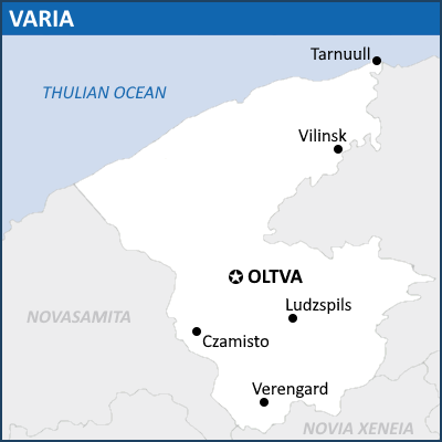
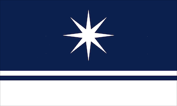
| General Overview | History | Geography | Government | Economy | Demographics | Culture | General Overview COMMONWEALTH OF VARIA Sodruzhestvo Variya (Oltvan) Motto : Dlya Luchshego Zavtra (For a Better Tomorrow) Anthem : Prekrasnoe Daleko (Wonderful Future) The Polar Banner Map of Varia Capital City Oltva Largest City Verengard Official Language Oltvan Acknowledged Languages Severo-Polosnian, Livanian Nationality (32%) Oltvans (27%) Polosnians (19%) New Varians (15%) Severnians (12%) Livanians (5%) Indigenous People Religion (73%) Borealists (19%) Atheism (8%) Others Demonym(s) Varian(s) Government Federal Semi-Presidential Republic (under One-Party rule) President Wojciech Kaminski Prime Minister Alfred Kalējs Assembly Speaker Orhan Akhmetov Legislature Upper House States Assembly Lower House Commonwealth Assembly Area 504,410 km2 (194,754 sq mi) Population 13,476,965 Density 26.7/km2 (69.2/sq mi) GDP PPP $433,70 billion (154,397.2 trillion VL) GDP Per capita $32,181 (11.46 million VL) Currency Varian Livre (VL) Time Zone IAT+0 Date Format dd/mm/yyyy Driving Side Left Calling Code +177 Internet TLD .vr Varia (vɑ:’ɾiɑ, va-RI-ya), officially the Commonwealth of Varia (Oltvan: Sodruzhestvo Variya) is a federation of eight nations, located in the northern hemisphere of Esferos, in the northern coast of the Doll-Guldur Continent. Varia borders the nation of Novasemita to the west, Novia Xeneia to the south, and the Thulian Ocean to the north. Varia covers a total area of 504,410 km2 (194,754 sq mi), and has a population of 13.5 million. Oltva is the capital city where the Commonwealth Government is based, while Verengard is the largest city by population and the financial centre of the nation. Varia is a multicultural nation, with no single ethnicity gaining a majority over the total amount of population. Despite this, Oltvan is considered to be its official language and serves as the lingua franca, being spoken by 32 percent of the population as their mother tongue. Varia’s climate is predominantly cold, with only a small area of warmer continental climate in the southern regions. Prehistoric human activity on Varian soil dates to around 10,000 BF, and the region has been continuously populated ever since. The territory of Varia has been multicultural, hosting different migratory people from time to time. The first of modern-day Varian ethnicities that inhabited the region is the Livans people, who settled on the very southern edge of the region in around 4,000 BF. The Severnians and Polosnians eventually invaded the region and pushed the Livans northward toward the Dalekie Mountains in around 2,100 BF and settled in the south. The Oltvan Great Voyage of the 3rd century saw several waves of Oltvan invaders defeating the former inhabitants and claiming much of modern-day Varian territory, bringing with them the Borealist faith. The Aurora Wars dominated the 4th century history of Varia, and The Kingdom of Oltva eventually emerged by the 5th century after King Vyacheslav united all factions of the Oltvan invaders. Between the 5th to the 9th century, Oltva expanded slowly over the other petty kingdoms of the Polosnians and the Severnians. However, a succession crisis and a state of anarchy ended the Golden Age of Oltva in 821 AF when the city of Oltva was sacked. The Eight Nations period lasted until the 12th century, filled with continuous wars while the region entered the age of enlightenment. Eventually, the Polosnian Queen Wyszesława completed a series of Polosnian expansions and united the eight Kingdoms under the Union of Varia in 1192. Varia remained a largely agrarian nation until the Varian Student’s Coup of 1291 forced the monarchy to agree on the Eight Nations Treaty of 1291, giving the minorities of Varia more rights, ending serfdom and bringing industrialisation to Varia. The new regime was soon dominated by wealthy aristocrats and industrialists, and the massive wealth gap triggered the 1321 General Strike and the end of the Monarchy. The newly proclaimed Commonwealth of Varia was unstable, however, and political disagreements led to the First Varian Civil War in 1324-1332 which ended with the dictatorship of Sviatopolk Ziminsky (1332-1351) and Yevgeniya Tavon (1351-1376). A state of anarchy enveloped Varia between 1376 until 1404 with the victory of the Varian Restoration Authority under Wojciech Kaminski. In 1408, constitutional reforms were implemented, but the Restoration Authority remained dominant over Varia to this day. Varia is a semi-presidential republic with its bicameral legislature comprising the Commonwealth Assembly and the States Assembly. Varia is considered a middling power and has a developing market with an upper-middle income economy. Varia has the fifth largest economy by total GDP and GDP per capita in Doll-Guldur, and its citizens enjoy average standard of living, and safety. Varia has a mixed-approach economic system, with both the government and private corporation contributing significantly to the economy as a whole. The state of Varia provides free education up to secondary education and universal health care coverage, though these services still lacking in terms of quantity and quality. Varia boasted hundreds of protected national parks and endangered habitats, and thousands of historic landmarks, supporting its developing tourism industry. Etymology The name Varia is an old Oltvan word that literally means "Various". The name was a shortening of the Union of Varian Crowns (Oltvan: Soyuz Varianskikh Koron), the name of the polity established by Queen Wyszesława in 1192. The name remained as the official name of the Commonwealth of Varia following the General Strike of 1321, in order to represent the various ethnicities and the multiculturalist values of the Commonwealth. There were attempts at renaming the Commonwealth, predominantly due to the name being very much descriptive in Oltvan. One such attempt was done by President Sviatopolk Ziminsky in 1333, into the Commonwealth of Polosnia, reminiscent of his own homeland. This attempt triggered a widespread protests across the country, which stopped the movement from ever going forward. Another attempt to rename it was in 1407, when several members of the Commonwealth Assembly argued to adopt the name of Commonwealth of the North (Oltvan : Severnoye Sodruzhestvo) or even the Polar Commonwealth (Oltvan : Polyarnoye Sodruzhestvo) but both did not receive widepsread support, the former due to its ambiguity, and the latter due to the fact that Varia was not located in the Continent of Polaris. Geographical Conditions Varia is located in the northern coasts of the continent Doll-Guldur. Geographically, it is located between 1°30'30" East - 8°10'10"East and 50°40'10"North - 59°10'10" North and is very near with the Meridian of Marcarius. Varia is bordered by two other states; the nation of Novasamita to the west and southwest and the nation of Novia Xeneia to the south. To the north, Varia is bounded by the Thulian Ocean, specifically the Proxima Thulia Sea. Varian territory is relatively flat but rugged, similar to the make-up of the majority of Doll-Guldur's landscape. The region is marked by lowlands on its extreme north and south, separated by highlands and the Dalekie Mountains in the middle. The highest point in Varia is Mount Północna, literally means "Mount North" due to the view of the Northern Stars from it's peak. Varia is located near the divergent boundaries of Doll-Guldur's two tectonic plates to the south of Varia. The divergent motion of the tectonic plates caused the formation of rift valleys in the south and a tectonically active region that oftentimes creates earthquakes. Due to the extremity of its northward location, Varia experienced high temperature variation between seasons. Temperature can fall to below -30° C in the northernmost point during winter, while in the south, in can reach 28 to 30° C in summer. The variation of temperature is caused due to climatic difference between the north and the south of Varia. South of the Dalekie Mountains, rain shadow effect caused the region to receive higher rainfall and is generally warmer, while north of the Mountains, the region is more colder and arid. Due to this, huge amount of Varia's territory is covered with Taiga Forests, with only a small and much more humid continental climate to the very southern point of the nation. Due to this phenomenon, the vast majority (78%) of Varia's population reside to the south of the Dalekie Mountains, while the north is mostly desolate with minor settlements near bodies of water and navigable rivers. Socio-Political Conditions Varia is a multiethnic state, composed of the Eight Nations of the Commonwealth, and multitudes of smaller indigenous people. These Eight Nations are, in order of population, Oltvina, Polosna, Sodnia, Severnia, Belina, Ineria, Livania, and Yashelia. Each of these nations has their own language, and unique traditions and values. Throughout Varia's history, these nations has been at war with each other, united and reunited multiple times, ultimately leading to the formation of the Union of Varian Crowns in 1192. Ever since, the Eight Nations has been living under a single state, and cultural mix was unavoidable. From new foods, to clothing, and even new dialects were established by inter-cultural mixing that happened under the Union, and later the Commonwealth. Varia today is a federalised semi-presidential republic, and put heavy importance on the sovereign authority of its member states. None of Varia's member states are elevated above the other, with the exception of the imposition of the Oltvan Language for the sake of convenience. Cultural and traditional values were protected from harm, and each states will negotiate as if they are different nations in settling disputes. With years of intermingling and government emphasis on multiculturalism, a new cosmopolitan group emerged from Varia's diversity, the so-called New Varians, who does not indetify from any of the Eight Nations, instead wholeheartedly embrace the plurality of Varia as a multiethnic state. These people dominates the urban landscape of Varia, and has only grown in number with passing time. The more conservative member of society viewed the New Varians with mild suspicion, fearing a dilution of their cultural heritage. Nevertheless, the Varian Restoration Authority under President Wojciech Kaminski remained committed to the unity and cohesion of the Commonwealth.
-
Térassic Estates Free Land Of Térassic Estates Tierras Libres dux Territorius del Térassico Flag Motto: Cada, un. "Every, one." Anthem: Tierra Del Sol Nasciente "Land Of The Rising Sun" Duration: 1 minute and 28 seconds.1:28 National Seal Sielo Nacional dux Territorius del Térassico National Seal of Térassic Estates Capital and largest city Del Sol Official language and national language Térassin and Common Ethnic groups 59% Térassian (mixed population) 35% Immigrant Desceandants 6% Indigenous Religion 66% Térassianism 54% Modern 12% Classic 39% no religion 5% other religions Demonym(s) Térassian Government Presidential republic • President Mila Arturo • Vice President Gelina Julius • President of the National Assembly Carlus Malta • President of the National Court Petros Augustus Magno Legislature National Congress • Upper and Lower House National Assembly Area • Total 135,285 km2 (52,234 sq mi) Population • Total 8,059,666 • Density 59,6/km2 (154,3/sq mi) GDP (PPP) In IMU • Total $372,1 bilion • Per capita $46,178 Currency Plur (p) Time zone IAT−1 Date format dd/mm/yyyy Drives on right Calling code +2 55 2-Letter Code TE 3-Letter Code TAE TLD .te Térassic Estates, officially the Free Land of Térassic Estates, is a presidential republic located in the southern part of the continent of Aura. The country is bordered by the Barry Sea to the west, the Serenity Sea to the east, and the Darkesian Sea to the southeast. It shares a southern border with Aktova, with which it shares the main island, and also includes smaller islands situated in the surrounding seas. Its geography is diverse, with coastal plains, mountains, and tropical forests that harbor rich biodiversity. The country has an area of 135,285 km² and an estimated population of 8 million people, with its capital Del Sol, which is home to around 1 million inhabitants. Throughout its history, Térassic Estates was an port nation, serving as a hub for trade routes between the continent of Aura and other regions. Its strategic location at the crossroads of maritime routes made the country a crucial point for the trade of spices, precious metals, and various goods. Del Sol, the capital, emerged as one of the largest port centers in the region, attracting merchants, immigrants, and explorers from various parts of the world, which shaped its cultural and demographic identity over the centuries. Térassic Estates gained independence after a series of peaceful revolts led by local merchants, dockworkers, and small farmers. The declaration of independence marked the end of colonial control and the beginning of a period of political and economic reorganization. Despite liberation, the new country inherited significant social inequalities, which were progressively addressed over the following decades. Térassic Estates adopts a Presidential Republic system. The current president, Mila Arturo, is known for her administration focused on progressive policies and social inclusion. Following the steps of previous administrations, her government has promoted the expansion of universal healthcare programs and access to public and higher education, as well as advances in technology, renewable energy, and sustainable tourism. Over the past few decades, the country has been an example in implementing progressive social policies. The universal healthcare system was established to ensure free medical care for the entire population. Additionally, the government expanded access to free public education, with the construction of new schools and universities, as well as incentive programs for higher education. The country is also recognized for its pro-LGBTQIA+ policies, being one of the regional leaders in civil rights for this community. Anti-discrimination laws, along with initiatives such as support centers and educational programs on gender equality, position Térassic Estates as a reference in social inclusion. Térassic Estates has a mixed capitalist economy with strong participation from both the public and private sectors. The country is the 11th largest economy in Aura, with an estimated Gross Domestic Product (GDP) of 372.1 billion IMU and one of the highest per capita GDPs in the region, reaching 46,000 IMU. Tourism is the most important sector of the economy, representing more than 60% of GDP. The country is famous for its paradisiacal beaches, tropical forests, and mountainous landscapes, as well as luxury resorts and cultural attractions in cities like Del Sol. Ecotourism has also been growing, focusing on environmental preservation and sustainable tourism. The Xamálica Nature Reserve, for example, is one of the most sought-after destinations for tourists seeking outdoor adventures and a connection with nature.
-
Free Land Of Térassic Estates Tierras Libres dux Territorius del Térassico Flag Motto: Cada, un. "Every, one." Anthem: Tierra Del Sol Nasciente "Land Of The Rising Sun" Duration: 1 minute and 28 seconds.1:28 National Seal Sielo Nacional dux Territorius del Térassico National Seal of Térassic Estates Capital and largest Del Sol Official language and national language Térassin and Common Ethnic groups 59% Térassian (mixed population) 35% Immigrant Desceandants 6% Indigenous Religion 66% Térassianism 54% Modern 12% Classic 39% no religion 5% other religions Demonym(s) Térassian Government Presidential republic • President Mila Arturo • Vice President Gelina Julius • President of the National Assembly Carlus Malta • President of the National Court Petros Augustus Magno Legislature National Congress • Upper and Lower House National Assembly Area • Total 135,285 km2 (52,234 sq mi) Population • Total 8,059,666 • Density 59,6/km2 (154,3/sq mi) GDP (PPP) In IMU • Total $372,1 bilion • Per capita $46,178 Currency Plur (p) Time zone IAT−1 Date format dd/mm/yyyy Drives on right Calling code +2 55 2-Letter Code TE 3-Letter Code TAE TLD .te Térassic Estates, officially the Free Lands of Térassic Estates, is a presidential republic located in the southern part of the continent of Aura. The country is bordered by the Barry Sea to the west, the Serenity Sea to the east, and the Darkesian Sea to the southeast. It shares a southern border with Aktova, with which it shares the main island, and also includes smaller islands situated in the surrounding seas. The country has an area of 135,285 km² and an estimated population of 8 million people, with its capital Del Sol, which is home to around 1 million inhabitants. Throughout its history, Térassic Estates was an important port nation, serving as a hub for trade routes between the continent of Aura and other regions. Its strategic location at the crossroads of maritime routes made the country a crucial point for the trade of spices, precious metals, and various goods. Del Sol, the capital, emerged as one of the largest port centers in the region, attracting merchants, immigrants, and explorers from various parts of the world, which shaped its cultural and demographic identity over the centuries. Térassic Estates gained independence after a series of peaceful revolts led by local merchants, dockworkers, and small farmers. The declaration of independence marked the end of colonial control and the beginning of a period of political and economic reorganization. Despite liberation, the new country inherited significant social inequalities, which were progressively addressed over the following decades. Térassic Estates adopts a Presidential Republic system. The current president, Mila Arturo, is known for her administration focused on progressive policies and social inclusion. Following the steps of previous administrations, her government has promoted the expansion of universal healthcare programs and access to public and higher education, as well as advances in technology, renewable energy, and sustainable tourism. Over the past few decades, the country has been an example in implementing progressive social policies. The universal healthcare system was established to ensure free medical care for the entire population. Additionally, the government expanded access to free public education, with the construction of new schools and universities, as well as incentive programs for higher education. The country is also recognized for its pro-LGBTQIA+ policies, being one of the regional leaders in civil rights for this community. Anti-discrimination laws, along with initiatives such as support centers and educational programs on gender equality, position Térassic Estates as a reference in social inclusion. The country occupies the northern part of the main island it shares with Aktova and also controls several smaller islands in the Barry and Darkesian Seas. Its geography is diverse, with coastal plains, mountains, and tropical forests that harbor rich biodiversity. Térassic Estates has a mixed capitalist economy with strong participation from both the public and private sectors. The country is the 11th largest economy in Aura, with an estimated Gross Domestic Product (GDP) of 372.1 billion IMU and one of the highest per capita GDPs in the region, reaching 46,000 IMU. Tourism is the most important sector of the economy, representing more than 60% of GDP. The country is famous for its paradisiacal beaches, tropical forests, and mountainous landscapes, as well as luxury resorts and cultural attractions in cities like Del Sol. Ecotourism has also been growing, focusing on environmental preservation and sustainable tourism. The Xamálica Nature Reserve, for example, is one of the most sought-after destinations for tourists seeking outdoor adventures and a connection with nature.
-
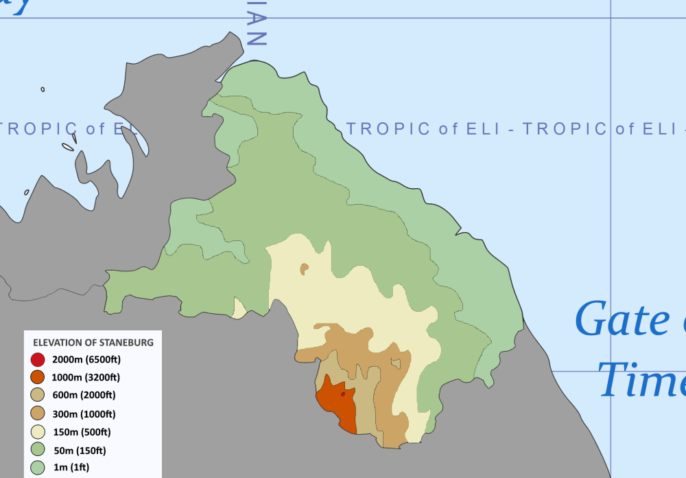
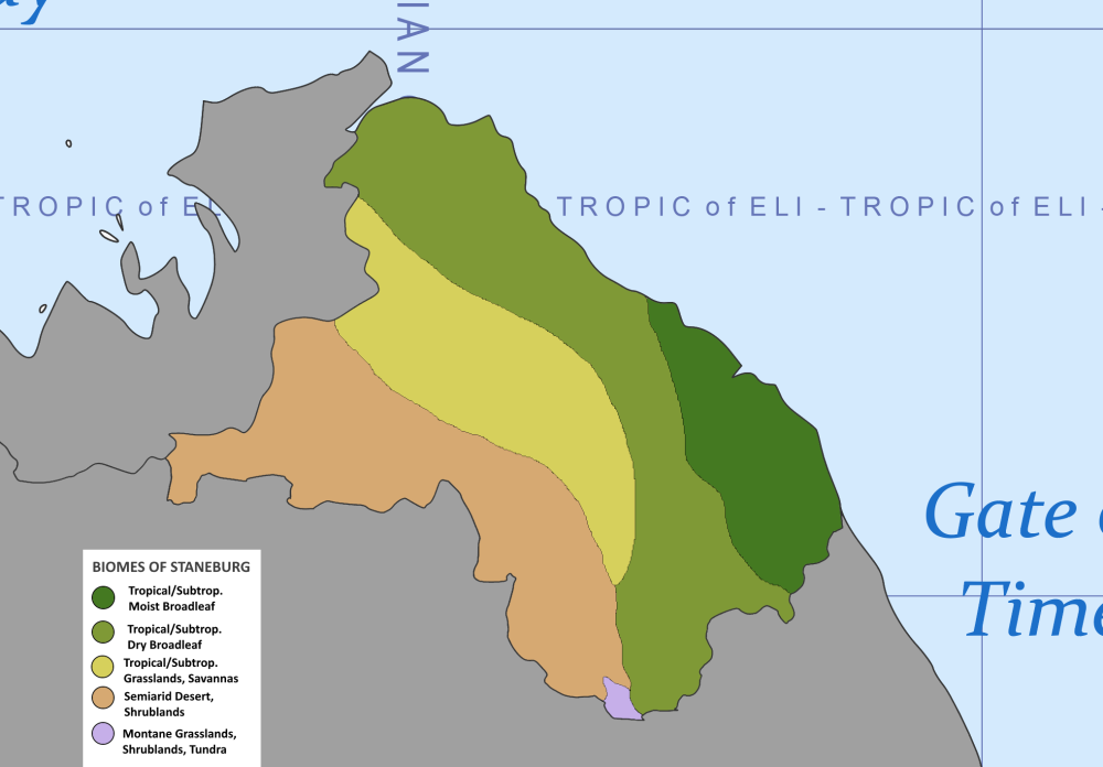
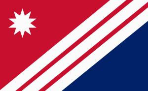
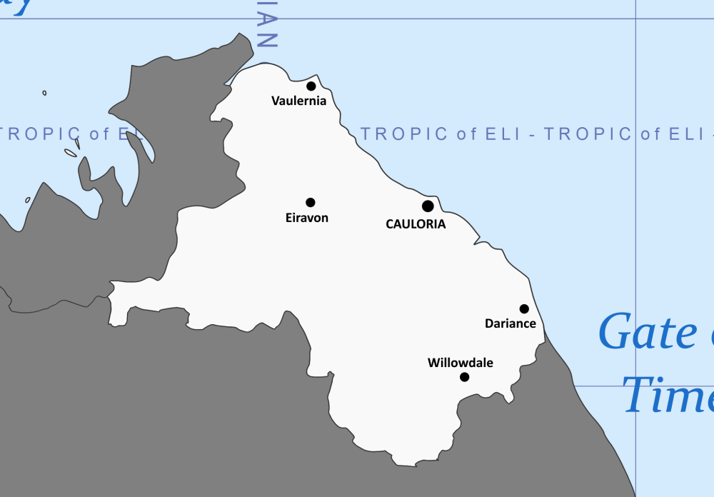
THE FEDERAL REPUBLIC OF STANEBURG Flag Seal Motto: Unity in Diversity Location of Staneburg in Aura Capital City Cauloria (Largest city) Demonym(s) Staneburgian(s) Government Federal Presidential Republic President James Wilton Vice President Karl Anderson Speaker of the House Jenny Hoffsburg Legislature Congress of the State Upper House The Senate Lower House The House of Representatives Judiciary The Supreme Court Chief Justice Alexander Corayson Land Area 187,139 km2(72,255 sq mi) Population 12,651,808 Density 67.6 km2 (175.1 sq mi) GDP (PPP) 470 Billion IMU Per Capita 37, 189 IMU Currency Stence Time Zone IAT+0 Calling Code +2 40 Country code SBG, SB Internet TLD .sbg General Overview Staneburg, officially known as The Federal Republic of Staneburg, is a country located in the northeastern coast of the continent of Aura in Esferos. The country is bordered by Greiya at its Northwestern border, Quistya at its southern border and the sea at its Eastern border. The country has a land area of 187,139 km2(72,255 sq mi). The administrative capital is the Federal City of Cauloria, which is currently the largest city in the country. Other notable cities include Vaulernia, which mostly acts as the entertainment hub of the country as well as being the second largest city in the country; Dariance, Eiravon and Willowdale. The population of the country is currently estimated at 12 million Staneburgians and a population density of 67.6 km2 (175.1 sq mi). The country is governed as a federal republic, which gives a certain level of power to the administrative divisions of the country. Geography Staneburg located at the northeastern coast of Aura has different climates and elevations across its borders. The country has its costal borders to be flat as compared to the inner borders. The northeastern part of the country as well as the coastal borders is characterized with an elevation of 1 metre (1 feet). The central part of the country is known to be quite hilly with an elevation of about 50 metres (150 feet). The highest point of the country is the Mount Alexis which has an elevation of 2000 metres (6500 feet). There are some inner parts of the country with a relatively flat land with the same elevation as the coastal parts of the country. The country has different climate conditions across its borders. There are about four main climate conditions which are experienced by the inhabitants of the country. The coastal parts as well as the central parts of the country are dominated by the tropical and subtropical conditions which causes the inhabitants in these areas to experience a high amount of rainfall annually. These areas are also characterized by their cold environment due to these conditions. The country also had a semiarid desert which passes through it at its southwestern borders. The average temperature of these areas during the summer period is estimated to be at 23° C. There are also savannas and grasslands located close to these areas. These areas are characterized by the presence of several grasses which spreads across the lands. Elevation of Staneburg Climate conditions of Staneburg Government Staneburg is a Federal Presidential Republic which is made up of three arms of government; these are the Executive branch which is headed by the President currently His Excellency James Wilton, who appoints a group of cabinet ministers approved by a majority vote in the Congress of the State. The President is assisted by the Vice President, currently His Excellency Karl Anderson who together with the President are elected on an election ticket by a majority vote by the qualified citizens of Staneburg. The Legislative branch is the Congress of State which is made up of two houses the upper house, The Senate made up of 20 senators and the lower house, The House of Representatives made up of 380 representatives. The House of Representatives is headed by the Speaker of the House currently Hon. Jenny Hoffsburg, elected by a majority vote of the members of Congress before the opening of a new congress. The Judicial branch has 10 justices headed by the Chief Justice, currently His Lord Alexander Corayson, who are appointed by the President with the approval of the Judicial committee of the Congress of State. The nation is governed at the local levels through a state government at the regional level and a municipal government at the city level. Economy The country of Staneburg has a growing economy that sustains the lives of inhabitants within its borders. The currency used by the nation is the Staneburgian Stence. The country's GDP (PPP) is currently estimated at 470 billion IMU. Its GDP per capita is 37,189 IMU. Staneburg's economy is currently sustained by its tourism sectors, which consist of tourist sites within the country as well as museums, which have some forms of art depicting the history of the country. The economy is also driven by its fishing sectors, which utilize the coastal borders of the country.
-
Official Name: Federal Republic of Aktova Short Name: Aktova Government Type: Dictatorship Capital City: Karakoy Location: Middle of the Barry Sea Geography Aktova is a maritime nation consisting of several small islands scattered across the Barry Sea, with its capital, Karakoy, located on the largest island. The country's geography is defined by rugged coastlines, deep harbors, and scattered forests inland. The island’s fertile land and proximity to rich fishing grounds make it an ideal hub for fishing, the country’s primary industry Climate: Temperate with cold, stormy winters and mild summers. Rain is common, and dense fog regularly rolls in from the sea, making navigation tricky. Natural Resources: Primarily fish, with some coal and timber reserves inland. The nation relies heavily on imports for industrial materials. Demographics Population: Approximately 11,800,000 Major Ethnic Group: The Aktovan people make up 85% of the population. Minority Ethnic Groups: There is a small Ferrumite minority from the neighboring nation of Ferrum Centrum, making up around 10% of the population. The remaining 5% consists of traders,tourists and immigrants from distant nations. Language Official Language: Aktovan (a unique language blending influences from nearby nations and ancient tribal tongues). Secondary Languages: Due to Aktova’s trading relations, Ferrumian is widely spoken, especially in commercial hubs. Religion Majority Religion: The Church of the Deep, a mysterious and ancient sea-based religion, is practiced by 70% of the population. It is based on reverence for the ocean and the deep waters, believed to hold spirits that guide the nation. The religion shapes much of the island’s culture, with festivals, offerings, and prayers performed before embarking on fishing expeditions or trading missions. Minority Religions: A small but growing irreligious group (around 15%) as younger generations increasingly distance themselves from traditional beliefs. Economy Aktova's economy is mainly dependent on fishing and trade, with ambitions to grow in technology and industry, despite its technological lag. Primary Industries: Fishing: The lifeblood of the nation. The waters surrounding Aktova are rich in fish, which are not only a food staple but also the country’s largest export. Trade: Aktova serves as a trading hub between its neighbors, leveraging its strategic location in the Barry Sea. The country primarily trades fish, coal, and timber for industrial goods. Shipbuilding: While still in a developing stage, Aktova has several ports where fishing vessels and warships are constructed. Coal Mining: Inland coal deposits, though not vast, provide enough fuel for internal needs, primarily in heating and shipbuilding. Currency: Golden Ingots Major Trading Partners: Aktova trades primarily with Ferrum Centrum and neighboring nations across the Barry Sea. Government and Politics Government System: Dictatorship Head of State: The Supreme Leader, who has absolute control over the nation.He rose to power after the previous government collapsed in the wake of a military-led revolution, which was supported by a popular uprising. The army failed to secure control. The current dictator was a politican who supported the idea of Democracy and freedom of speech but he didn't have those views forever. His paranoia stems from the violent nature of the rebellion and the fear that any political freedom could spark another uprising. The strong presence of Socialist sentiment among the people, which still lingers, adds to his concerns, making him wary of any movements or ideologies that might challenge his rule. Political Ideology: National unity and stability are paramount. The state promotes a strong sense of nationalism and reverence for the ruling regime. Law and Order: Aktova has a strict legal system, with harsh punishments for dissent or criminal activity. Political opposition is not tolerated, and there is a heavy police presence in major cities, particularly in Karakoy. Military: Aktova’s military is small, though the government prioritizes building its naval forces. The military budget has increased significantly over the past decade, but the nation is still in the process of modernizing. Aktovan Navy: Small but growing, with the goal of becoming dominant in regional waters. Aktovan Guard: The elite force charged with protecting the Supreme Leader and key government facilities. Administrative Divisions Aktova is divided into five administrative regions, each governed by a regional commander loyal to the dictator. These regions are: Karakoy: The central region (it's in the south tho), housing the capital city and the country’s main trading port. Borrevik: The agricultural heartland, where the bulk of the country’s timber and food production occurs. South Islands: The southern islands, sparsely populated but strategically important for naval outposts. Western Aktova: Literally just the western part of Aktova. It has great beaches and 2 large cities and ports. That's about it. Our Only Well Known City Karakoy: The capital and largest city, with a population of 450,000. Karakoy is the cultural, political, and economic heart of Aktova. It boasts bustling markets, ancient sea temples, and military outposts. The harbor is crowded with both fishing boats and military vessels. Despite the dictatorship, the city is lively, with public squares filled with merchants, entertainers, and local street food vendors. Society and Culture National Identity: Aktovans see themselves as seafaring people, deeply connected to the ocean. The sea plays a prominent role in their daily lives, influencing everything from their religion to their cuisine. National pride is strong, and the government promotes a unified vision of an Aktova that will one day control the seas. Cuisine: Seafood dominates Aktovan cuisine. Popular dishes include: Seaweed Stew: A rich stew made with fish, seaweed, and root vegetables. Smoked Fish: Often enjoyed with thick, grainy bread and local sea salt. Karakoy Crab: A rare and expensive delicacy found only in the waters around the capital. Festivals: The Festival of the Deep is the most important holiday in Aktova, where citizens gather to offer prayers and sacrifices to the spirits of the ocean. Boats are decorated with flowers and candles, and the harbors are filled with celebrations, music, and feasts. Education and Literacy: Education in Aktova is free but basic. The focus is on practical skills like fishing, navigation, and military training. Literacy rates hover around 75%, but higher education is underdeveloped, with only one main university located in Karakoy. Foreign Relations and Military Aktova maintains an alliance with Ferrum Centrum, a neighboring island nation, which shares Aktova’s goal of controlling regional trade. Both nations collaborate on military efforts, though Aktova is the junior partner in this relationship. Despite being technologically behind, Aktova dreams of building a powerful navy to control the Barry Sea. Aktova has strained relations with some neighboring countries due to its ambitions. However, the nation strives to avoid open conflict, focusing instead on building its economic and military strength. The dictatorship also maintains a strict control of information, using propaganda to present Aktova as a rising power, destined to dominate the region. Aktova’s development is slow but steady, with ambitions to become a major player in regional politics, primarily through the strengthening of its navy and economy. The sea is both its lifeline and its guiding force, and the nation's future is tied to its ability to harness the power of the ocean. (aktova wanted me to publish this here because he was going on a trip or smth idrk)
-
The Kingdom of Mygrdiyah Overview | Geography | Politics & Government | Economy | Culture An Overview Mygrdiyah, officially the Kingdom of Mygrdiyah, is a country in western Nur. Geography [PLACEHOLDER] Politics & Government [PLACEHOLDER] Economy [PLACEHOLDER] Culture [PLACEHOLDER] (OOC Note: This thread is still very much a work-in-progress. New information about my nation will be added here as I continue to worldbuild.)
-
--/ Khesed-Emmeria Institute for Ancient Research & North Point D∴G \-- --/ Administration Passcode Required \-- _____________________ --/ FLASH IDENT \-- --/ FLASH IDENT \-- _____________________ --/ VISUAL IDENTIFICATION APPROVED \-- --/ ACCESSING FILE: THE ORIGINS OF EMMERIA \-- --/ END OF FILE \--
-

factbook The Sultanate of Arifiyyah
Arifiyyah posted a topic in Atlas of the Occident - Map & Factbooks
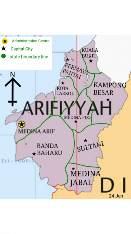
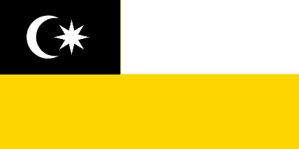
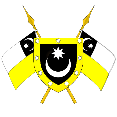
OVERVIEW ARIFIYYAH DARUL FIKR Flag Coat of Arms Motto: God is Great Location Arifiyyah is located on the continent of Aura in the TWP World -Population:12,759,036 -Density: 320 people/km² Main Name:Arifiyyah Darul Fikr Capital:Medina Arif City Largest City:Banda Besar City Official Language: Arifianic,Common National Language:Arifianic Demonym:Arifian Government: - King:Sultan Arif Nazhim Shah(Sultan Arifiyyah IV) - Chief Minister: Tun Bendahara Rais Zuhdi -Minister of Defence: Dato' Ilham Mustaqim -Minister of Finance, International Trade and Economy:Danial Mukhriz - -Minister of Foreign Affairs:Lee Jian Ying -Minister of Home Affairs:Albert Johnston Legislature: - Upper House: Majlis Pentadbiran Negara - Lower House: Dewan Rakyat Land Area: 39 871 km² Water Area:197.86km² Water %: 0.42% GDP (nominal):AFR61.5 Trillion GDP (nominal) per capita:AFR 10,117 Human Development Index (NS Version):67.75 Currency:Arifiyyah Ringgit(AR) Time Zone:UTC+8 Drives on the:Right Side Calling code:+60 Internet TLD:AF RUKUN NEGARA BANGSA(PILLARS OF NATIONSTATES) Rukun Negara Bangsa became the ideology and the core of the lives of Arifiyyah leaders and communities which was inaugurated by Sultan Nazim Shah, Sultan Arifiyyah II to foster togetherness among the people regardless of appearance, age, way of life and religion. Consist of eight pillars. Arifianic Language Bahawasanya kami,rakyat ARIFIYYAH berikrar dan berjanji akan menumpukan taat setia kepada negara dan mengamalkan kehidupan masyarakat bertamadun berteraskan prinsip-prinsip berikut: 1. Kepercayaan kepada Tuhan 2. Kesetiaan kepada Pemimpin dan Negara 3. Keluhuran Perlembagaan 4. Berilmu dan Berakhlak Mulia 5. Berintegriti dan Bermaruah 6. Kedaulatan Undang-undang 7. Bersatupadu dan Kebersamaan 8. Memelihara Negara,Agama dan Bangsa English/Common Language That we, the people of ARIFIYYAH pledge and promise to devote loyalty to the country and practice the life of a civilized society based on the following principles: 1. Faith in God 2. Loyalty to Leader and Country 3. Supremacy of the Constitution 4. Knowledgeable and Noble 5. Integrity and Dignity 6. Rule of Law 7. Unity and Togetherness 8. Preserving the Country,Religion and Nation MAP OF ARIFIYYAH -

factbook The Grand Republic of Ionia
Ionia posted a topic in Atlas of the Occident - Map & Factbooks
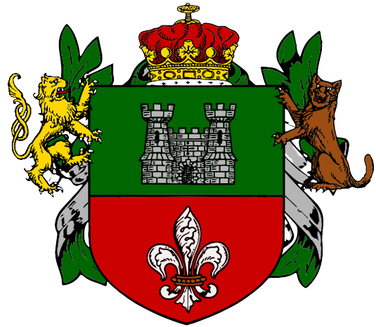
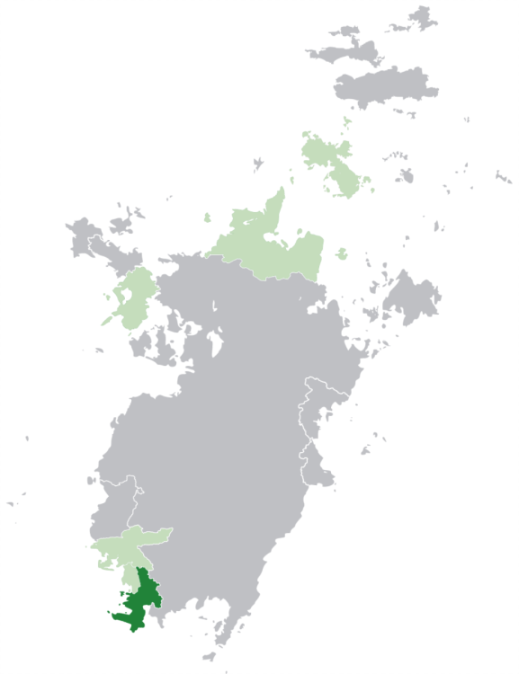
Ionia The Grand Republic of Ionia (Ionian: Grandsrepublikke Jonien) is a sovereign country located in Southwestern Nur. It borders Sekiya to the north, Rivalfiume to the northwest and the Viatic Ocean from the west to the southeast. Astenburg is its capital and also its financial and cultural centre, housing 1 million out of Ionia's total 8.07 million residents. Ionia presents great diversity across the nation, in biomes as well as ethnic minorities of the nearby nations. The geography mainly consists of mountainous forests, with oceanic, flat areas and other types of enviroments along the coasts and high montane areas. The Grand Republic of Ionia Grandsrepublikke Jonien (Ionian) The location of Ionia (dark green) in Nur (gray) and the NCC (light green) Flag Banner Emblem Official languages: Common, Ionian Recognized minority languages: Fluvian, Sekiyan, Kalmachian Demonyms: Ionian, Ionist Capital and largest city: Astenburg 2nd largest city: Tila Ethnicities (1423): 93.7% Ionians, 3% Fluvians, 2.1% Sekiyans, 1.2% Kalmachians Religion (1423): 76.5% atheism/agnosticism, 20.2% non-aligned, 3% yellowism, 0.3% indigenous/other Government: Unitary presidential republic President: John Doenston Legislature: Bunderenaat Chambers: Oberenaat (Senate), Udernaat (Lower House) Constitution declaration: 20 March 1404 Surface area: 556,416 km2 (27th) Population (1423): ▲ 8,077,738 (58th) Population density: ▲ 14.5/km2 (65th) HDI: ▲ 0.876 (very high) GDP (PPP, 1423): ▲ $218.2 billion (55th) GDP per capita (PPP, 1423): ▲ $27,012 (53rd) Currency: Ionian Mana (Ɱ, IOM) Exchange rate: $1 = 2.5 Ɱ Country codes: IO, ION Calling code: +5 17 Internet TLD: .io Driving side: Right Date format: DD/MM/YYYY Numbering system: 123,456.789 Time zones: +5 IAT -
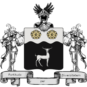
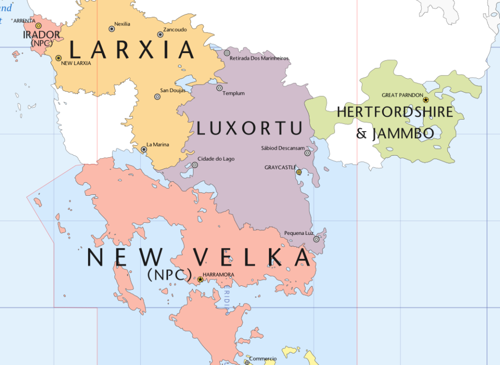
The Federal Premier-Presidential Republic of Luxortu National symbols: Flag: Coat of arms: Motto: "Fortitudo per Diversitatem" (Markian) "Strength through Diversity" Location: General info: Capital city: Graycastle (Castelo Cinzento) Largest city: Cidade do Lago Official language(s): Luxortan (de facto) Ethnic groups: Luxian 94.54% Larxian 3.20% Other Andolian Immigrants 2% Other 0.26% Demonym(s): Luxian, Lux (colloquial) Religions: Eilini Hasoqir 80.98% Plalins Hasoqir 11.22% Vyng Hasoqir 4% Other Hasoqir 1.5% Atheism 1.2% Other 1.1% Constituent (): Government: Federal Premier-Presidential Republic (O Castelo Cinza (The Gray Castle) - the Parliament building.) Head of State: Senhor Protetor (Lord Protector): Head of Government: Chanceler do Estado (State Chancellor): Legislature: Parliament Upper House: Casa dos Senhores Lower House: Cámara dos Comuns Formation: () Statistics: Area: 790,688 km² Population: 15,355,852 GDP: Total: $ 390,791,082,777 Per capita: $25,449 Currency: Luxian Rupiah Time Zone: Date format: dd/mm/yyyy Diving side: Left Calling code: +3 30 Letter Code: 3: Lux 2: Lu
-
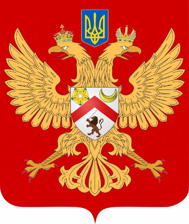
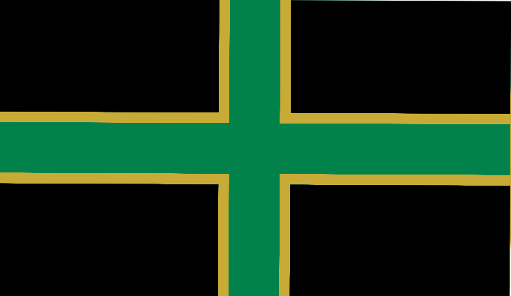
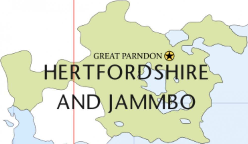
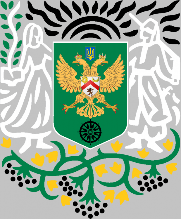
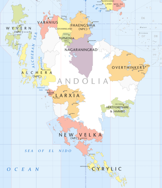
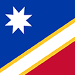
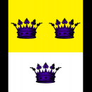
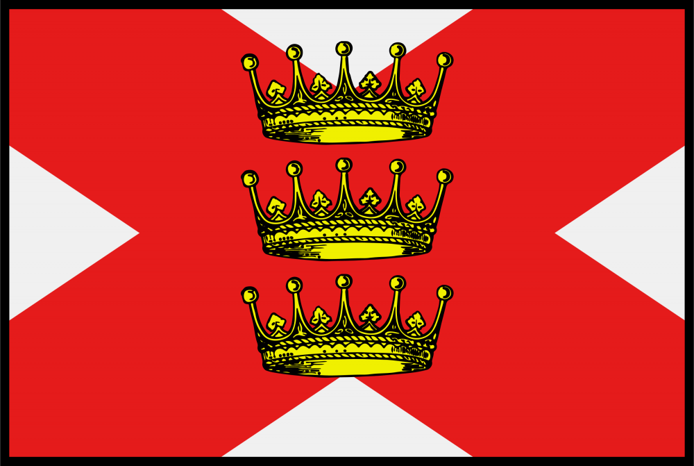
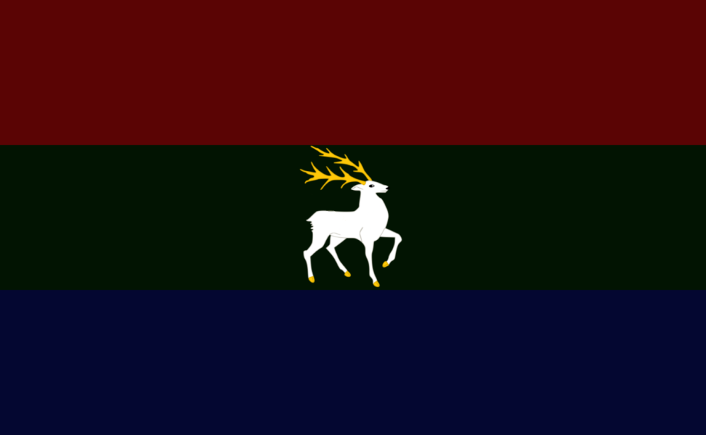
The Tsardom of Hertfordshire and Jammbo/Hertfordia - Herts101 Hertfordshire and Jammbo is a mid-sized nation in South-East Andolia. The Tsardom borders the Great Pacific Ocean to the south and east, has no borders to the north and west. Disregarding bordering nations, Hertfordshire and Jammbo is to the south of Overthinkers (OT), directly to the east of Larxia, south-east of Nagaraningrad and is north-east of New Velka. It holds one of Andolia's largest lake groups within its borders. ■■■■■■■■■■■■■■■■■ The Verkhovna Anglia was the Parliament of the nation. It usually held 700 seats, but could fluctuate between 698-702 depending on how the STV went in the elections, which occur every 4 years. Political parties are not a concept in Hertfordshire and Jammbo, and it was voted in 1422 for it to remain that way. In 1423, the nation became a Tsardom and the Verkhovna Anglia was abolished. The nation is currently an elective absolute monarchy. The Government (As of 1423): Tsar: Mecislavs Deben I ■ ■■■■■■■■■■■■■■■■ Anthem: ??? ■■■■■■■■■■■■■■■■■ Codes: HEJ, HF, .hj Calling Code: +3 80 Time Zone: IAT+0, IAT+1 ■■■■■■■■■■■■■■■■■ Capitals: Great Parndon, Hoddesdon, Maidenhall Denonym (Noun): Hertfordian Denonym (Adjective): Jammbonian Denonym (Plural): Hertfordians/Jammbonians Government: Confederal Elective Absolute Monarchy Monarch: Tsar Mečislavs I of House Deben ■■■■■■■■■■■■■■■■■ Continent: Andolia Area: 129,181mi^2 (334,577km^2) Population: 3,203,688 Density: 24.8 people/mi^2 (9.6 people/km^2) ■■■■■■■■■■■■■■■■■ GDP: Δ100,129,024,637 ($122,108,566,630) GDP/Capita: Δ31,254.30 ($38,115) Currency: Delta Pound (Δ/δ) Rate of Exchange: $1 = Δ0.82 ■■■■■■■■■■■■■■■■■ Real Life Cultural Inspirations: England (Essex, Hertfordshire, Suffolk), Ukraine, Latvia, Bulgaria Languages: Anglian, Jammbonian, Hertmerian, HJ Sign Language, Common Religions: 49% Church of the Countryside, 23% Eastern Orthodox Church of Jammbo, 8% Agnostic, 7% Gensokyan Shinto, 4% Atheist, 3.5% Other, 2% Hertmerian Paganism, 1% Pirate Church, 1% Temple of the Black Sun, 1% Hall of Dreams, 0.5% Cult of Nihilism ■■■■■■■■■■■■■■■■■ Military/1000 Capita: 51.5 Military (Total): 164,990 Conscription: Yes Spending (% of GDP): 2.9% Spending (Total): Δ2,903,741,714 ($3,541,148,432) ■■■■■■■■■■■■■■■■■ Flag: National (Lesser) Coat of Arms: National (Greater) Coat of Arms: Anglian Royal Army: Anglian Royal Air Force: Anglian Royal Navy: Pirate Fleet of Hertfordshire and Jammbo: Royal Privateer Fleet of Hertfordshire and Jammbo:
-
The Federal Republic of the Vergville Population: 8,317,360 people Pop density: 80 km^2 Land Area: 103,967 km^2 TLD: .vg Calling code: +1 28 Time zone: IAT -4 Demonym: Vergen; Vergens Currency: Popper Overview: The small republic was founded on the principles of democracy and populism. As a result, the parties formed a basis of a decentralized government, a confederation of sorts. But being situated in Polaris, the lingering threat of war and invasion has brought the nation closer and closer to the establishment of a federation. For the protection of the population, the right winged populists paved the way to conscription laws, whilst the left wing organized plans of economy for the start and duration of any incoming war. Despite all ethnic and racial differences, the republic had to bring in an era of cooperation between the 3 racial populations that split up the nation. The republic started with no form of military until the formation of the National and Provincial guards during the newly established federation. They are the Coast Guard, the Federal Guard, the Local Guard, and the Republic's Guard. The Federal and Coast Guard act as the nation's army and navy. The Local Guard act as a militarized police force within their local province, capable of bringing peace to their respective communities as well as a regulatory inspected militia. Then there's the Republic's Guard, the nation's new air force, it is amongst the most significant and important aspects to the nation's defense, as the nation lacks the natural defense besides its hills and forests. For now, peace has been established for the small republic across its territories and provinces.
-
REPUBLIC OF DASKEL Ministry of Communications Daskel, officially Republic of Daskel, is developing, cultured nation. The nation current number of citizen is 82 million Daskelians. Daskel is ubicated in the coasts of El Nido, south of The West Pacific. The nation's closest neighbor countries are Hertfordshire and Jammbo, Comia Noracon, Larxia, Irador and Acadie. It's capital city is Daito Metropolis, which currently holds roughly 10 million habitants. Daskel is well known for their interesting coastal geography in the west side of the country, where many citizens built their home in on the hills, giving the place a colorful, bright look. Orca sightings are fairly common on Daskelian sea. The animal is protected by the law, and tourists come to the beaches each day with the hopes of encounter one in the wild. The overall nation geography is tinged with mountains and valleys, giving the west side of the country a really good looking landscape. The mountain range on the west is called The Royal Sanmyaku. It's practically a daskelian tradition to travel through the mountain to get to the beach each summer. Daskelian government is currently making progress in Education, Welfare and Healthcare. Culture is highly appreciated in the nation. For that reason, arts and sports have a special public funding. The economy of the nation is developing, and Tourism has a huge impact in it. CHANGELOG March 16 Created Thread April 9 First Legislation Draft April 9-12 Creation of Daskel's map July 28 Comeback. Graphics updated on legislation and map. Names of the prefectures were changed due to Nation reformulation process through the year. Legislation and geography were separated. Economy section was started. [WORK IN PROGRESS]
-
PrologueGreetings, historical adventurer! This book contains facts and trivia about the foundation and history of Marisala during the Founders' Era. All facts have been verified by historians and philosophers certified by the Historic Division of the Marisala Science Ministry and Royal University of Marisala. This book is provided courtesy of the Marisala Heritage Museum. Please read the following carefully: Required information due to the Jones-Kennedy Act of 1325 This edition renders all previous editions obsolete. All previous editions are to be removed from public libraries, archives, and other areas where such editions are used as research tools. Any past reports, papers, teaching devices, and/or similar devices that contain data from previous editions are to be amended (using this edition) or terminated immediately. Failure to do so will result in a 1500N fine and/or 30 days jail time, pending action through a civil court. Private sales of previous editions (e.x. book shops, antiques, auctions, etc.) and collection of said editions are approved. Fifth Edition Updates: Founders' landing date recertified. Clarification on the founding of Bamney Religious Seminary provided. Removal of erroneous and conflicting data regarding King Joseph II (herein known as the Tyrant King). Death date for Queen Mary V amended. "Scientiam Et Fidem" Fin Important Facts Name: Marisala Motto: "Scientiam Et Fide" (Science and Faith) Flag: Government Type: Triumvirate Current Leaders: H.M. King Alexander IV (Currently incapacitated. King Regent Prince Jonathan Moore) Executive Chancellor Edwin Brommel Cardinal Daniel Burke Location: Northeastern Polaris (Pending map approval) Timezone: Polaris Eastern Time Currency: Notro (Singular in all forms) Currency Type: Coin and Note Currency Abbreviation: (Proceeds amount. e.x. 20N) Note: N (e.x. 20N) Coin: n (e.x. 20n) Coin Denominations: 1, 2, 5 Note Denominations: 20, 50, 100 National Language(s): Common National Religion: Currently unestablished Timeline Jan. 1029 A.F. The G.S. Bountiful Sea makes it's landing on what is now known as Founders' Docks. The Colony of Bramsea is established w/a population of 545. A hard winter strikes in the coming weeks, killing 50. Supplies from the ship (including the ship itself) are used to make proper shelters and armaments for colony residents. Those who did not survive the voyage are given proper burials and funerals. A protected colony is established by the end of the month. Feb. 1029 A.F. The first Marisalan legal document on record is drafted by Lord Edwin Brooks. This document, The Bramsea Charter, establishes the sovereignty of His Lordship as leader and protector of the colony and acknowledges the rights of The Faithful and The Proletariat. Fellow draftees include Fr. Petyr Willow, Winship Brooks, and Dr. Mathis Black. The document is ratified by the colony in a landslide vote of 495-0. Lord Brooks establishes an exploration party to go west and further chart the land of their nation. Additional instructions state that they are to act as emissaries to other nations. The party contains roughly 50 people. Daniel Lewis is born to Marcus and Sarah Lewis, becoming the first child born to colony residents. April 1029 A.F. Word reaches Lord Brooks that the exploration party entered the nation of Tara and Cambray on accident. While unpunished, the interaction helped to establish a border between the two nations. Two lakes were also discovered, named Hope and Providence (Respectively). Five of the party members return with news of another established colony by the exploration party at Lake Providence, with the colony taking the same name. Aug. 1029 A.F. The first crime in the country is committed. The murder of Lucy Potts of the Lake Providence Colony places both colonies under heavy political strain. At the time, The Bramsea Charter only provided laws for the colony of Bramsea and leaving Lord Brooks as the sole judiciary member. The crime resulted in the first trial in the country. The trial lasted for three days and the defendant, Caleb Potts was found guilty. As a result, The Bramsea Charter was amended to extend all legal authority to Lord Brooks, regardless of what colony or township the crime occurred in. This amendment set the stage for future political problems within the budding nation. Sept. 1029 A.F. As the population between the two colonies increases, so does crime. To purge the criminals, Lord Brooks orders them and their families to be deported throughout the territory en masse. The intent is that the offenders would die off in the wild. This plan backfired with the creation of the Lake Hope, Brooks Folly, Crow’s Landing, and Winchester colonies. Despite the deportation, the colonies now fall under Lord Brooks by virtue of The Bramsea Charter, angering the newly formed colonies. Lord Brook’s son, James Brooks marries Susan Hoff, officially establishing the first Lordly House in the nation. Fr. Petyr Willow is named the Bishop of Bramsea by Lord Brooks. The Bramsea Charter is amended once again to give him parochial and religious authority over the colonies. Nov. 1029 A.F. Several boats arrive, bringing new citizens, goods, and occupations to Bramsea and the budding nation. With the main colony itself almost full to bursting, there is no choice but to expand the colony. This decision destroys a portion of the farmland outside the colony but with ample food stores and help from Tara And Cambray, the colonies will survive the winter. Lord Brooks makes several more amendments to The Bramsea Charter. Most notable changes are the following: · Officially designating the colony grouping as a nation. Named Marisala, after Brooks deceased wife (Marisa). · Appointing Colony Governors to serve in his name in all colonies. · Establishing Founder’s Day (In which the anniversary of the founding of Bramsea and the nation is celebrated annually on Jan. 5). · Creating an official currency (the Notro) and flag. · Allowing the purchase of Lord/Lady titles for a fee. · Establishes the creation of defensive lawyers, law courts, and prosecutors in all colonies. · The colonies are officially designated cities/towns. Ironically, the governors had no jurisdiction in terms of the law and were expected to follow Lord Brooks laws and decisions. Dec. 1029 A.F. Lord Brooks officially declares taxes on all perishable goods moving within the nation. This sparks protests from national farmers and forces Lord Brooks to create a moderately sized army. The army is quickly disbanded after the protesters scatter but has proved that the nation is vulnerable to civil war and has begun to expose political issues. Brooks introduces a new method to pass laws in order to assuage angry political protestors. The process is simply introducing the law to the Marisala Bar and allow it to be voted on by a Governor. If a majority of the six governors approve, the law is passed. After approval from his inner council, Brooks introduces The Conscription Act as a test law. Briefly, all male Marisalan citizens between the ages of 18-25 must serve a minimum of two years in a hastily formed National Army. The law is approved with a vote of 5-2. Those with prior military service are called to serve as commanders and enlisted leaders. The result is the creation of small forts and barracks outside the cities. It should be noted that despite the governor’s votes, most Marisalan citizens were against the mandatory conscription. Jan. 1030 A.F. The first Founder’s Day is celebrated across the nation. Construction of The Cathedral of Our Lady of Great Help in Bramsea begins. Lord Brooks also orders construction to begin on his private residence (now known as Bramsea Palace). June 1030 A.F. Susan Brooks, wife of The Honorable James Brooks, gives birth to twin sons. There are now five additional Lordly Houses established: House Kent of Lake Providence, House Deanbury of Brook’s Folly, House Chichester of Crow’s Landing, House Brough of Winchester, and House Cloddagh of Lake Hope. Construction of The Cathedral of Our Lady of Great Help is complete and Bsp. Willow is installed as rector. Lord Brooks approves the construction of various churches and temples across the nation. Brooks also approves of the construction of Bamney Religious Seminary and a small town around it. Citizens flock to the newly built town. July 1030 A.F. Construction on Lord Brooks’ private residence is completed. The building is named Founder’s Landing. Nov. 1030 A.F. Construction on Bamney Religious Seminary in the town of the same name is completed. The first class of seminarians is admitted later that month. Dec. 1030 A.F. To decrease government debts, Lord Brooks institutes a flat sales tax of 7%. Lord Brooks health begins to fail and his son, Hon. James Brooks, prepares to take his place. Days before the new year, Bsp. Willow complains of displays of public drunkenness. Hon. Brooks then introduces the Alcohol Reduction Act. The introduction of the act sparks outrage from all cities and towns and thousands of citizens turn out in protest in front of the governor’s residences. The National Army is called in to hold back the crowds. Only minor injuries are reported, and the act fails to pass after 3 days of a tied vote of 3-3. Aug. 1031 A.F Both Lord Edwin Brooks and Gov. George Hartman of Lake Providence die of natural causes. Hon. James Brooks inherits his father’s title and installs Prosecuting Attorney James Banks as Lake Providence Governor. Lord James Brooks also inherits all administrative and executive actions of his father through The Bramsea Charter. (WIP)
-
The United Communes of Dayadhvam Dayadhvam is born out of the union of the diverse anarchic communes living on the Isle of Camoha. Population: 5 million Capital city: Damyata Other notable cities: Dattavam, Zeimakavam Language: Varied dialects of Dayadh (Most important: National Dayadh, New Bhandi, Zeimak) Demonym: Dayadh(s) Currency: wheat grains (though exchange of goods happens mostly via bartering) Ruler: N/A Government: Mostly inexistent; The Council of Datta (comprised of elders from the various communes) gathers in Dattavam once a month to discuss local and national affairs Religions: Varied and numerous, though a majority practises Funyarinpism
-
Overview │ Geography │ Demographics │ History │ Politics │ Culture │ Economy │ Infrastructure Notable Figures │ Map Repository │ Other Graphics and Images OVERSYN // OVERVIEW Fujai (fu:'jaɪ, foo-yEYE), officially the People's Communes of Fujai (Fujansk: Folkskommunarna Fujai), is a communal socialist directorial republic located in and near the Thulian Ocean in northern Polaris. It is comprised of the island of Saisland, portions of the Setgård islands, and the regions of Hasmark and Lannreid on mainland Polaris. Fujai also lays claim to the areas of Lannreid and Setgård controlled by Dalimbar since the 1200s. — - People's Communes of Fujai Folkskommunarna Fujai (Fujansk) - Flag Coat of Arms Anthem: Arbetarna (Common: The Workers) Motto: For alltid framover, for alltid nordover (Common: Forever forward, forever northward) Location of the People's Communes of Fujai (red) in Polaris (red, dark grey, & light grey) Capital and largest city Keiserholde Official Languages Fujansk First Languages: 76.3% Fujansk dialects 4.6% Kynsk 1.9% Gloisk 1.1% Other North Berganisk 1.1% Dalimbari 15.0% Other Demonym(s) Fujar (noun) Fujansk (adjective) Fujar (plural) Government Communal socialist directorial republic • Rådsrodd Iren Kristoffshavn • Velktingstalar Aina Landsvik • Hovudmidjar Aldis Steredal Legislature Velktinget History • States prior to unification by the early 500s • Unification of Saisland and Hasmark 1021 • United Kingdoms of Fujai and Glorijk 1042 • Gulhatt Republic 1113 • Re-established monarchy 1134 • Lannreid Forbund joins 6 June 1211 • People's Commune 26 April 1316 Population • 1420 census 7,294,825 • Density 13.9/km² Area • Total 521,912 km² • Water (%) 6.8 (1415) Elevation • Highest point 2,265 m - Trondhelm • Lowest point Sea level - Thulian Ocean GDP (PPP) 1424 estimate Total 521.84 billion IMU (12.84 trillion FJK) Per capita 71,535 IMU (1.760 million FJK) Currency Fujansk krone (FJK) Time zone IAT-3 (PCT Polaris Central Time/ SPT Sentriskpolaris tid) Driving side right Calling code +1 48 Country codes FJ FJA Internet TLD .fj Fujai has a total area of 521,912 square kilometers and a population of 7.3 million, mostly concentrated in south and west Saisland and south and east Hasmark. The country is bordered by Dalimbar on the east, shares an extensive border with Cambria to the south, and in the east borders Gloibria and the Cambric exclave of Corentin. Much of its coastline, especially in Saisland, is broken by deep fjords, with large areas covered by forest, tundra, and mountains. Its maritime location heavily moderates its climate, making it relatively temperate compared to its latitude in the east and south, with its coldest locales located in the northwest. Humans have inhabited what is now Fujai since approximately 11,000 BF. Berganisk peoples have inhabited the region since at least 2800 BF, being recorded in history in the centuries before the Markian Founding as the Saisar, Hasar, and Lanning, comprising along with the Glorar and and the peoples known as the Næring. The period from roughly 200-500 AF was characterized by migration, settlement, and raiding along the coasts of northern and eastern Polaris. Independent states emerged in Hasmark and Saisland in the early 500s, uniting into the precursor to the modern Fujansk state in 1021. The personal union of Fujai and Gloibria occurred in 1042 in response to growing Cambric influence in the region, failing in 1113 due to the Fujansk Civil War, which established the short-lived Gulhatt Republikk before the monarchy's restoration. The next two centuries were characterized by increasing Dalimbari aggression, with the Lannreid Forbund joining Fujai for protection in 1211, and a succession of wars eating away at Fujai's western territory throughout the 1200s, leading to increased alignment with the Astorians to the south. The disastrous First Northern War (1309-1312) dramatically reduced Fujai's area and began an economic depression leading to the Fujansk Revolution, which established the Red Monarchy, a socialist directorial republic with an elected ceremonial monarch. After a decade of economic reorganization, the ceremonial monarchy was abolished in 1331, leaving the current system in place. The Second Northern War (1357-1365) resulted in the return of much of Fujai's land to mid-1200s borders, and aided in Fujai's postwar economic success. On an international level, Fujai has been closely aligned with the Astorian Union (AU) for over a century, primarily as a defense against Dalimbar, and while not a full member, is a signatory of many AU treaties. Fujai is one of the few nations to use a directorial system of government. Executive power is vested in the seven-member Stadsråd (State Council), and its members and its Rodd (Voice) are directly elected yearly. The Velkting forms the legislative branch and has the power to initiate recall elections for the Stadsråd. Iren Kristoffshavn serves as the current Rådsrodd, Tova Landsvik as the Speaker of the Velkting, and Aldis Steredal as the Hovudmidjar (Head Mediator). Fujai uses a democratic socialist economy with universal healthcare, education, housing, transit, and an extensive social security system. These are funded with some of the highest and most progressive taxes in the world. Profit is outlawed in Fujai, and most companies operate as worker cooperatives or are under public ownership. Much power is delegated to the local kommunar, which often leads Fujai to be termed a "decentralized" or "municipal" state, while acknowledging the immense influence of the central government. Other values central to the Fujansk system include the landsuveren (land sovereign) and bypraksis (city practice). Fujai maintains an extremely high ranking in many international metrics, including quality of life, health, education, protection of civil liberties and political freedoms, equality, prosperity, and human development.
-
Asraelia A nation of tea in a region of Coffee The Asraelian Nation Flag Asraelia is a small nation with rich culture, and diversity. Asraelia can be described as one big community, even the biggest cities still have a small town feel to them where everyone knows everyone, and everyone is friendlyand greets each other on the street. The Cities of Asraelia are styled to represent the people that live in it. Asraela is a melting pot of all its cultures, the cities are build around public areas, that are filled with small restaurants, cafes and bars, and every weekend these areas are filled with live music and dancing. Asraelia has a very retro feel to it, as the people have a retro taste Country, Swing and Sokkie are the dances of the hourand Rhythmy Blues and Old time Rock en Roll can be heard all through the night. Too Be Continued


.thumb.jpg.08b489aafe429f279e583a32cdfd8ba7.jpg)

.thumb.png.e64f703a8a97253f8c2d817d376b3d56.png)
.thumb.jpg.373861a16116c1f898cd4f76d7e79c3a.jpg)












.png.719bdfbe0f2749cbe6c8dcbbd1b72c37.png)
.png.1d5d59b20b83cb3b9cb030b101f1aa7e.png)
.png.d8a066af17aa7e66318b59ddbdb464e3.png)
.png.804053a62b797f7d1ec5b291ae50a7e7.png)
.png.88afe47785f7697a8eb193dc950db0a2.png)
